
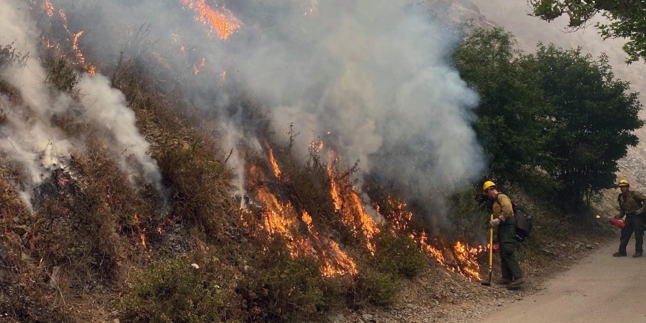
Over 16,000 firefighters continue working to gain containment on the 28 major wildfires across California. Even though 13 new wildfires erupted yesterday, only one in Siskiyou County grew beyond the initial response firefighters’ control. With improved weather conditions, containment numbers increased on all of the fires, with some quickly approaching full containment.
Since the beginning of the year, wildfires have burned over 3.2 million acres in California, which is larger than the State of Connecticut. Since Aug. 15, when California’s fire activity elevated, 19 fatalities and over 4,000 structures were destroyed.
While weather conditions have improved compared to last weekend, warm and dry conditions persist through much of the state, although onshore flow early next week should help with humidity levels. With the changes in weather conditions, we may see the return of critical fire weather next week. Red Flag conditions are in effect in the very northern part of California on Sunday, bringing gusty winds and low humidity to the Modoc National Forest and the Tulelake Basin.
Do you know that if your home’s power goes out before you can evacuate from a wildfire, your escape can become much more challenging, especially if it is dark outdoors? No lights, being unable to open your garage door, and finding your go-bag are just a few of the obstacles you should prepare. To learn more about dealing with power outages, visit ReadyForWildfire.org.
Fires of Interest:
Dolan Fire, Monterey County (more info…)
Hwy 1, 10 miles south of Big Sur (Los Padres National Forest)
*115,440 acres, 30% contained
*Structures threatened
*Type 1 NW Team 2 (Allen) in command
Creek Fire, Fresno County (more info…)
Northeast of Shaver Lake (Sierra National Forest)
*196,667 acres, 6% contained
*Evacuations in effect
*Heavy tree mortality in the area
*CAL FIRE and US Forest Service in unified command
*CAL FIRE Incident Management Team 1
*Great Basin Team 1
**CAL FIRE Incidents**
Shackleford Fire, Siskiyou County (more…) NEW
Southwest of Quartz Valley Reservation
*50 acres, 10% contained
Willow Fire, Yuba County (more info…)
Willow Glen Road, Dobbins
*1,311 acres, 40% contained
*Evacuations in progress
Oak Fire, Mendocino County (more info…)
North of Willits
*1,100 acres, 50% contained
*Evacuations in place
LNU Lightning Complex, multiple North Bay counties (more info…)
Napa, Lake, Sonoma, Colusa, Solano, and Yolo Counties
*363,220 acres, 95% contained
*Hennessey (merged fires) 305,651 acres, 95% contained
*Wallbridge 55,209 acres, 95% contained
*1,491 structures destroyed
*5 fatalities
*Evacuations in place
*CAL FIRE Incident Management Team 2 in command
SCU Lightning Complex, multiple Easy Bay counties (more info…)
Contra Costa, Alameda, Santa Clara San Joaquin, Merced, and Stanislaus Counties
*396,624 acres, 98% contained
*20 fires in the complex, several have merged together
*Evacuations and road closures in place
*224 structures destroyed
*CAL FIRE Incident Management Team 6 command
CZU August Lightning Complex, San Mateo and Santa Cruz Counties (more info…)
*86,509 acres, 86% contained
*Multiple fires
*Evacuations and road closures in place
*1,490 structures destroyed
*1 fatality
*CAL FIRE Incident Management Team 3 command
Schoolhouse, Siskiyou County (more info…)
Schoolhouse Gap Road, north of Fort Jones
*45 acres, grass and brush, 60% contained
*Forward spread stopped
**Unified Command Incidents**
North Complex, Plumas County (more info…)
Southwest of Susanville (Plumas National Forest)
*252,313 acres, 21% contained
*9 fatalities
*Evacuations in place
*Includes the Bear and Claremont Fire
*CAL FIRE Team 4 is now in unified command with US Forest Service IMT Team 4
Valley Fire, San Diego County (more info…)
Near Alpine (Cleveland National Forest)
*17,665 acres, 69% contained
*Evacuations in effect
*CAIIMT 15 in command
*CAL FIRE and US Forest Service in unified command
El Dorado Fire, San Bernardino County (more info…)
West of Oak Glen (San Bernardino National Forest)
*14,403 acres, 39% contained
*Evacuations in place
*California Interagency Incident Management Team 11 in unified command with CAL FIRE, Yucaipa Fire Department and San Bernardino County Fire Department
Butte/Tehama/Glenn (BTU/TGU) Lightning Complex, multiple Counties (more info…)
Butte, Tehama and Glenn Counties
*19,609 acres, 95% contained
*Includes multiple other smaller fires
*Decrease in acres as Elkhorn was moved to the August Complex.
*16 structures destroyed
**Federal Incidents**
August Complex, Tehama County (more info…)
Elk Creek and Stonyford area (Mendocino National Forest)
*846,812 acres 25% contained
*1 fatality
*Merged fires including Elkhorn, Hopkins, Willow, and Vinegar
*Includes multiple fires including the Doe Fire
*A California Interagency Incident Management Team and Great Basin Team in command
*A CAL FIRE Incident Management Team is deployed on the west zone of the fire.
Fork Fire, El Dorado County, (more info…)
15 miles northeast of Pollock Pines (El Dorado National Forest)
*1,647 acres, 7% contained
*Evacuation orders remain in place
Slater Fire, Siskiyou County, (more info…)
5 miles North of Happy Camp (Klamath National Forest)
*125,894 acres, 0% contained
*2 fatalities
*The Devil Fire has now merged with the Slater Fire
*Evacuations orders in place
Bobcat Fire, Los Angeles County (more info…)
North of Duarte
Angeles National Forest
*29,245 acres, 6% containment
*Evacuations in progress
*EA Silver Team in command
Lake Fire, Los Angeles County (more info…)
Southwest of Lake Hughes
Angeles National Forest / Los Angeles County Fire Department
* 31,089 acres, 96% contained
Apple Fire, Riverside County (more info…)
Oak Glen/Cherry Valley (San Bernardino National Forest)
*33,424 acres, 95% contained
Red Salmon Complex – Humboldt County (more info…)
14 miles northeast of Willow Creek (Shasta-Trinity National Forest)
*83,620 acres, 18% contained
SQF Complex, Tulare County (more info…)
25 miles north of Kernville (Sequoia National Forest)
*68,093 acres, 12% contained
*Castle and Shotgun Fires merged into this complex
W-5 Cold Springs, Lassen County (more info…)
11 miles east of Madeline (Bureau of Land Management – Northern CA District)
*84,817 acres, 98% containment
Blue Jay Fire, Mariposa County (more info…)
Yosemite National Park Wilderness
*3,132 acres, 20% contained
Wolf Fire, Tuolumne County (more info…)
Yosemite National Park Wilderness
*798 acres, 10% contained
Woodward Fire, Marin County (more info…)
3 miles southwest of Olema (Point Reyes National Seashore)
*4,910 acres, 95% contained
Slink Fire, Mono County (more info…)
2 miles west of Coleville (Humboldt-Toiyabe National Forest)
*23,117 acres, 45% contained
Moraine, Tulare County (more info…)
Sequoia and Kings Canyon National Parks Wilderness
*575 acres, 70% contained
Rattlesnake, Tulare County (more info…)
Sequoia and Kings Canyon National Parks Wilderness
*1,411 acres, 0% contained
Top 20 Wildfire Records
- 5 of the Top 20 largest wildfires in California History have occurred in 2020.
- Largest Wildfires – # Aug. 1 Complex (Elkhorn Fire was merged with the August Complex), #3 SCU Lightning Complex, #4 LNU Lightning Complex, #9 North Complex, and #16 Creek Fire.
- Most Destructive – #9 LNU Lightning Complex and #10 CZU August Lightning Complex
- Deadliest Wildfires – #11 North Complex, and #20 LNU Lightning Complex